20 KEARSARGE AV
Owner Information
CITY OF BOSTON
KEARSARGE AVE
ROXBURY, MA 02119


Property Details
20 KEARSARGE AV is classified as a IMPUTED - Exempt (School).
The primary structure on this property was built in 1875. There are 65,474ft2 of built area within this property. There is 65,474ft2 of residential/living space within this property.
20 KEARSARGE AV is valued at $14,023,000. The land is valued at $6,191,500 and the structures are valued at $7,731,900. There is an additional valuation of $99,600 on this property.
20 KEARSARGE AV was last sold on Thursday, January 1, 1987 for $0.
Assessment data from fiscal year 2020.
Flood Data
According to the FEMA National Flood Hazard Layer, this property does not appear to be in a flood zone. It may also be in an area not yet reviewed. Nonetheless, confirm this information prior to taking any action.
To view the flood hazards around this property, create a FEMA "Firmette" Map of the area around 20 KEARSARGE AV.
Broadband Internet Providers
| Provider | Type | Bandwidth (mbps) | |
|---|---|---|---|
| HughesNet | Satellite | 25 | 3 |
| GCI Communication Corp. | Satellite | 0 | 0 |
| netBlazr Inc | Fixed Wireless | 50 | 50 |
| Starry, Inc. | Fixed Wireless | 200 | 200 |
| Comcast | Cable | 1000 | 35 |
| TPx Communications | Copper Wire | 0 | 0 |
| Verizon New England Inc. | Fiber | 940 | 880 |
| VSAT Systems, LLC. | Satellite | 2 | 1 |
| Verizon New England Inc. | DSL | 15 | 1 |
| USAi.net, Inc. | Fixed Wireless | 0 | 0 |
| Viasat Inc | Satellite | 100 | 3 |
| MCI | Copper Wire | 0 | 0 |
| Crown Castle Fiber | Fiber | 0 | 0 |
Broadband service provider data from December 2020.
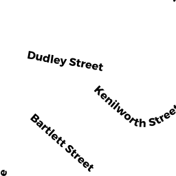
Adjacent Properties
- 26 WINTHROP ST
Housing Authority owned by MEKANE HIWOT SAINT MICHAEL - 24 WINTHROP ST 3
Residential Condominium owned by BIVENS WENDY K - 24 WINTHROP ST 2
Residential Condominium owned by BULGER LEO J TS - 24 WINTHROP ST 1
Residential Condominium owned by HARRIS HARJABEN - 24 WINTHROP ST 4
Residential Condominium owned by WHITE TARONDA L - 24 WINTHROP ST
Other, Open Space owned by TWENTY 4 WINTHROP ST CONDO - 22 WINTHROP ST
Apartments with Four to Eight Units owned by DICKERSON LEO B - 20 WINTHROP ST
Apartments with Four to Eight Units owned by HUANG XIAOLAN - 35 GREENVILLE ST
IMPUTED - Exempt owned by CITY OF BOSTON - 25 GREENVILLE ST
Single Family Residential owned by PONTES JOSE F - 2123 GREENVILLE ST
Other Congregate Housing (includes non-transient shared living arrangements) owned by LORENZOVEST HOLDING CORP - 17A GREENVILLE ST
Two-Family Residential owned by JONES NADINE M - 19 GREENVILLE ST
Single Family Residential owned by RODRIGUES MARCELINO - 19A GREENVILLE ST
Single Family Residential owned by GOMES RAULINA - 17 GREENVILLE ST
(formerly Charitable Organizations (private hospitals, etc...). Removed June 2009. ) owned by HOME FOR LITTLE WANDERERS - 21- 23 WARREN PL 21
Residential Condominium owned by STREETER GWENDOLYN - 21- 23 WARREN PL 23
Residential Condominium owned by VALENZUELA JOSE - 21- 23 WARREN PL
Other, Open Space owned by TWENTY1 -23 WARREN PL CONDO - 17R WARREN PL
Undevelopable Residential Land owned by URBAN LEAGUE OF EASTERN MASS INC - WARREN PL
Undevelopable Residential Land owned by OLIVA ANTONIO * NUNZIATA - 67 KEARSARGE AV
(formerly Religious Organizations. Removed June 2009.) owned by GORDON-CONWELL THEOLOGICAL - 89 PEVEAR PL
Undevelopable Residential Land owned by 6-9 PEVEAR LLC